-
×
 Raymarine Axiom XL Accessory Pack
1 × $ 386.66
Raymarine Axiom XL Accessory Pack
1 × $ 386.66


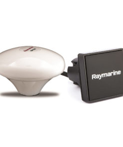
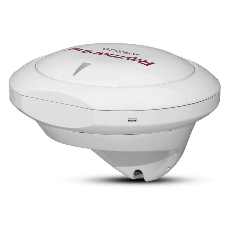
Raymarine AR200 Augmented Reality Stabilization Module
$ 589.52 excl. VAT
Raymarine’s AR200 video stabilization module includes a precision GPS/GNSS sensor and the same attitude heading reference sensor (AHRS) technology used in Raymarines Evolution autopilots. Combine the AR200 with a compatable IP camera or thermal camera and benefit from the ClearCruise Augmented Reality features readily available on your Axiom multifunction display.
Raymarine AR200 Augmented Reality Stabilization Module
The AR200 is an Augmented Reality Sensor consisting of a Global Navigation Satellite Systems (GNSS) Receiver and an Attitude and Heading Reference System (AHRS) sensor. The AR200 provides position, heading, pitch and roll data to compatible Axiom MFDs. When combined with a compatible IP camera or thermal camera, the AR200 enables use of the ClearCruise™ Augmented Reality features available on your Axiom MFD.
Make smarter decisions
See critical navigation objects overlaid on HD video. Surrounding AIS-equipped vessel traffic and charted navigation aids are clearly identified with rich graphics on a live, dynamic video image.
Recognize and respond to nearby marine traffic
Color-coded labels provide instant identification, status, and risk-assessment Live AIS Targets. ClearCruise AR provides positive identification of AIS equipped vessels on the horizon.
Understand complex navigational situations
Major chart objects are identified for instant, heads-up recognition. ClearCruise AR technology shows you visually where your saved waypoints and marks are located.
See your waypoints in the real world
Visualize nearby marks and waypoints for easy navigation. ClearCruise AR technology makes it easy to pick out the buoys marking the edges of the safe channel on a hazy day.
Raymarine AR200 key features
- 9-axis AHRS (attitude and heading reference system) sensor
- 28-channel GPS receiver
- Fast 10Hz position updates
- Satellite differential GPS-compatible. Space-Based Augmentation System (SBAS) enabled with WASS, EGNOS, MSAS and GAGAN support
- When combined with a compatible IP camera the AR200 enables the use of ClearCruise Augmented reality features available on Axiom multifunction displays
- NMEA 2000 compliant
- IPX6 / IPX7 waterproof rating
TECHNICAL DETAILS
MODEL | RAYMARINE AR200 |
Power Specifications | |
Nominal supply voltage | 12 V dc (Supplied by the SeaTalkng® network.) |
Operating voltage range | 9 V dc to 16 V dc (protected up to 32 V dc) |
Power consumption | 30 mA Max. |
LEN (Load Equivalency Rating) | 1 |
Environmental | |
Operating temperature range | -25 ºC to +55 ºC (-13 ºF to 131 ºF) |
Storage temperature range | -25 ºC to +70 ºC (-13 ºF to 158 ºF) |
Relative humidity | 93% |
Water ingress protection | IPx6 and IPx7 |
Conformance | |
EMC directive | 2014/30/EU |
Australia and New Zealand C-Tick compliance | Level 2 |
RoHS directive | 2011/65/EU |
WEEE directive | 2012/19/EU |
GNSS Receiver | |
Signal acquisition | Automatic |
Channels | Simultaneously track up to 28 satellites. |
Operating frequency | 1574 MHz to 1605 MHz |
Update rate | 10Hz |
Sensitivity | Cold start = -147 dBm Re-acquisition = -160 dBm Tracking = -164 dBm |
GNSS compatibility | GPS GLONASS Galileo ready Beidou ready |
Satellite differential type (SBAS) | WAAS (United States) EGNOS (Europe) MSAS (Japan) GAGAN (India) QZSS ready (Japan) |
Differential acquisition | Automatic |
Position accuracy without SBAS (95%) | < 15m |
Position accuracy with SBAS (95%) | <5m |
Speed accuracy (95%) | <0.3m |
Time to first fix from cold start | <2 minutes (<60 seconds typical) |
Time to first fix from hot start | <45 seconds |
Geodetic datum | WGS–84 |
Antenna | Internal |
AHRS | |
AHRS | 3–Axis digital accelerometer 3–Axis digital compass 3–Axis MEMS Gyro digital angular rate sensor |
Magnetic compass accuracy | Static = ≤1° RMS Dynamic = ≤3° RMS |
Pitch, Roll and Yaw accuracy | ≤1° |
Heading, Pitch, Roll and Rate of Turn update rate | 10Hz |